Public, Private, & Tribal Lands
Humboldt & Trinity Counties
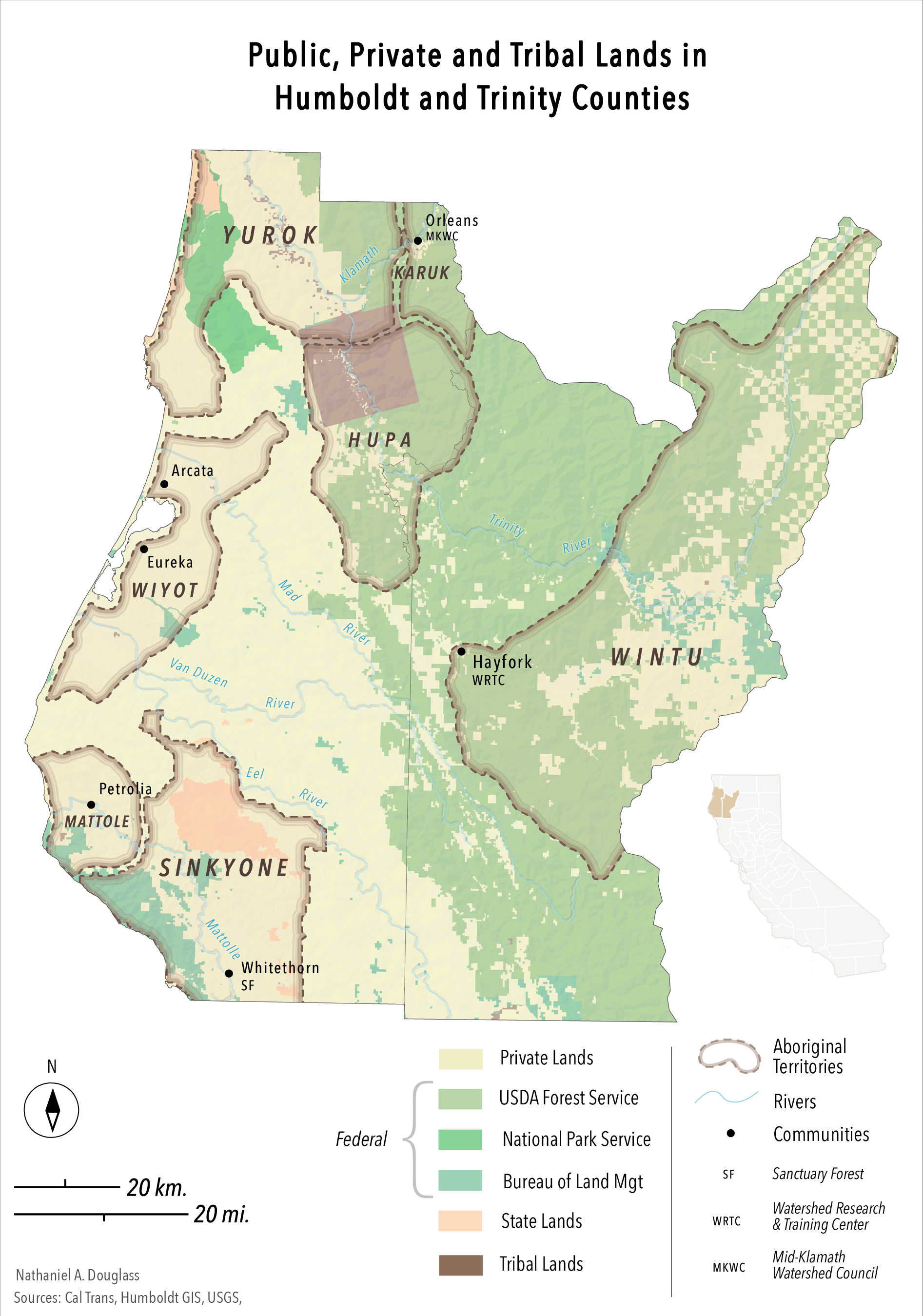


A commissioned map for a research paper regarding marijuana cultivation on tribal lands.
The client asked for a map depicting the overlap in land ownership and pre-European native territories. These aboriginal territories were digitized from another map and only include a selected few tribes by the client.
A light Swiss hillshade and offset concentric halos were used.